|
|

|
|
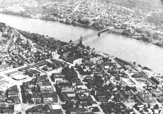
This picture gives a good view of the 100 block of East 3rd Street. The main right to left street near the bottom is Market Street. The main bottom to top street in the center is East 4th Street. Looking to the right of 4th street you will see East 3rd Street.
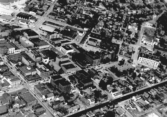
This picture gives a nice view of East 3rd from Market to Washington (though the actual intersection of Market and East 3rd is cut off) and Washington to Union and a little beyond Union towards Broadway.
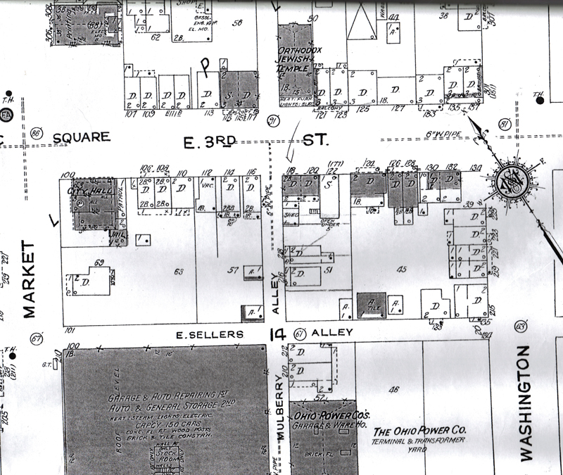
The map showing the 100 block of East 3rd Street. That block was bordered by Market Street on the west and Washington Street on the east. From 1923 Sanborn Fire Insurance Map.
The following pictures cover a time period from early 1900s though the 1960s-70s. The 100 block of East 3rd Street was primarily a residental block. Having said that there are some exceptions. From 1878 until 1935 City Hall was located at the beginning southeast corner of the block. There was also an orthodox Jewish Temple on the north side of the block for a long time and later in the 1900s there was one or two small mom pop type grocery stores on the south side of the block near Washington. The Moose Club was locate in this block later in the time period covered here as well.
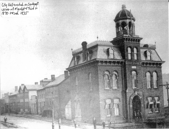
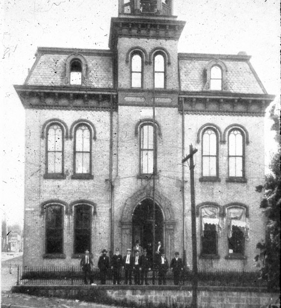
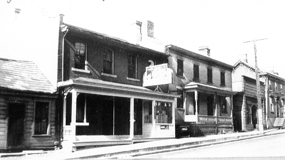
City Hall. The lean to at the back was used by the fire department. Also visible in the picture are the following houses: the double house at 106-108, the houses at 110, 112, 114, 116, and double house at 118-120 E 3rd St. Picture from Inger Lloyd collection.
Year unknown. ELHS slides.
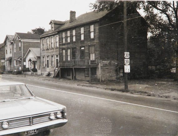
This and the following two pictures are difficult to date. It appears that perhaps this and the next picture might be from the 60s and the third picture might be from the 1970s. Picture from MOC.
Picture from MOC.
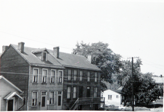
Probably 1970s.Inger Lloyd Collection.
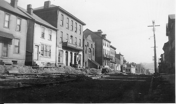
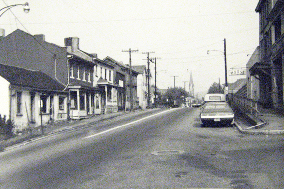
The intersection of Market and East 3rd Street after City Hall was torn down but in 1935 but before the street was torn up to remove the trolley tracks in late 1935. Picture from MOC.
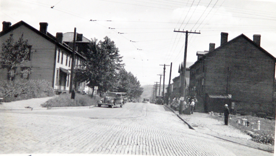
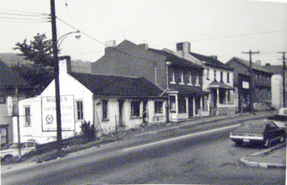
Moving down the street, the north side of the street. The removal of the trolley tracks November 5, 1935. In the above picture you can see the far right of 111, East 3rd, 113, 115-117, barely see the alley, 119 (Orthodox Jewish Temple), 121-123, 125, 127, 133, 135, 137 East 3rd Street. You can even see the first building in the 200 block of East 3rd street, Graham & Wagner Memorials on the Northeast Corner of Washington and East 3rd Street. Inger Lloyd Collection.

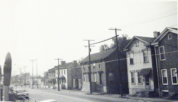
Shown here are 107-119, 111 which is a double house but for some reason only one street address shown on the Sanborn map, 113, 115-117 E 3rd Street. Notice how smooth the street is, The Trolley tracks are gone and the street has been redone. Picture from MOC.
The south side of the street. Visible are the following: 114, 116, Alley, 118 - 120, 122, 126 -128, 130 and 132 East 3rd Street. Picture from MOC.
A slightly different angle showing a bit further down the street, We begin here with the alley and the double house at 118- 120 East 3rd Street. In this Picture you can see a sign on one of the buidlings towards the end of the block. Inger Lloyd Collection.
This view looking west shows the same sign. It was a small grocery store. The address was 130 East 3rd Street. Inger Lloyd Collection.
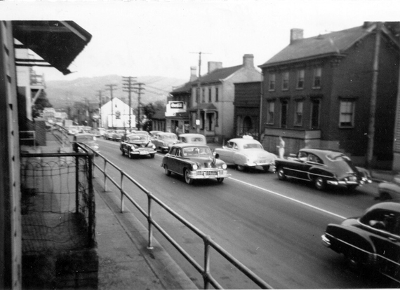
This is standing towards the north side of the street at the intersection of Washington and East 3rd Street looking west up the 100 block of East 3rd Street. Picture from MOC.
This picture finishes our recreation of the 100 block of East 3rd Street. Picture from the MOC.
Most of the pictures used here were taken around mid 1960s. We do have at least one that probably was from the 1970s and possibly two from 1935. Two pictures, of the old City Hall were before 1935.
Based on the 1958 City Directory there were 23 occupied street addresses and one vacant address for the 100 block of East 3rd street. Three addresses were listed as busineses, 122 was Tweed uphol. and 130 Magill's Grocery and 132 was Magill's Chinaware.
The 1970 City Directory lists 15 addresses. two addresses identified parking lots, 105 was a municiple Parking lot and 132 was Magill's Grocery parking lot. Two addresses were vacant. Two addresses were businesses, one was a private club, The Moose Club. Seven addresses were private residents.
In 1975 13 addresses with two being parking lots. One business remaining, five vacant addresses. One private club still and 5 occupied homes.
In 1980 13 addresses. Two parking lots, one business, onre private club. There were four vacant addresses and occupied homes.
In 1985 1 parking lot and 1 private club.
In 1990 1 parking lot and 1 private club.
In Limbo: 200 Block, East Third St.
This site is the property of the East Liverpool Historical Society.
Regular linking, i.e. providing the URL of the East Liverpool Historical Society web site for viewers to click on and be taken to the East Liverpool Historical Society entry portal or to any specific article on the website is legally permitted.
Hyperlinking, or as it is also called framing, without permission is not permitted.
Legally speaking framing is still in a murky area of the law though there have been court cases in which framing has been seen as violation of copyright law. Many cases that were taken to court ended up settling out-of-court with the one doing the framing agreeing to cease framing and to just use a regular link to the other site.
The East Liverpool Historical Society pays fees to keep their site online. A person framing the Society site is effectively presenting the entire East Liverpool Historical Society web site as his own site and doing it at no cost to himself, i.e. stealing the site.
The East Liverpool Historical Society reserves the right to charge such an individual a fee for the use of the Society’s material.