|
|

|
|
POINT OF BEGINNING, DEDICATION.
"Dedication of "Point of Beginning" Marker, September 30, 1960 - (175th Anniversary).
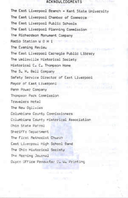
The pictures in this group: Creator - Dawson, Harold A.. Location Depicted - East Liverpool (Ohio). Time Period - Decline and Comeback: 1960-1990, Date Original - 1960 - Collection - East Liverpool Collection.- Digital Publisher - Cleveland Memory Project. - Donor - East Liverpool Historical Society - Repository - East Liverpool Historical Society.
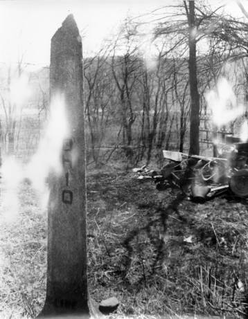
Original 1785 Marker of "The Point of Beginning" for the U.S. Federal Land Surveys located on the Ohio-Pennsylvania Description This is the original marker that marks "The Point of Beginning" of the Township and Range survey system that resulted from the Federal Land Ordinance of 1785.

"The beginning of the U.S. Public Land Survey has been designated a registered National Historic Landmark. Under the provisions of the Historic Sites Act of August 21, 1935 this site possesses exceptional value in commemorating or illustrating the history of the United States. U.S. Department of the Interior National Park Service, 1966."--Plaque on the "north face" of the marker. This monument c. 1960 at the Ohio/Pennsylvania border in East Liverpool, denotes the "point of beginning" for surveying the public lands of the United States that resulted from the Federal Land Ordinance of 1785. Ohio became the proving ground for the rectangular system of surveying (one-mile square sections of land, etc.) that prevails in almost every state west of this point.

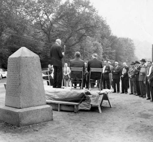
A 1960 dedication of the Point of Beginning. "Dedication of the Southern Terminal Monument, 'Point of Beginning' at the Ohio Pennsylvania border. The man in the chair on the speakers left is William 'Judge' Vodrey and his son William Vodrey Jr. is the speaker." Present were five representatives of American Congress on Surveying and Mapping. Locally William Vodrey Jr. presided at state line program."
SOME PERSONAL ACCOUNTS: Sarah Webster Vodrey I know my grandfather WHV III and his father WHV II worked hard on all sorts of projects that we in the 21st century still benefit from (WHV II - helping to found the EL Historical Society, overseeing the reforestation of the lands around Fredericktown where his mother was from, assisting the YMCA, and more, WHV III - spearheading the creation of the Museum of Ceramics, promoting the Point of Beginning markers, saving of bottle kilns in Wellsville and on East Liverpool's Second Street, also working on reforestation, and land preservation around Fredericktown, saving the Thompson Hotel tile floor and arranging for it to be reinstalled in the Museum of Ceramics where it is still enjoyed today, writing a book about the Sandy & Beaver Canal with his friend R. Max Gard, and writing other history related books to try to preserve our ceramics history, for starters). I'm pleased to see them mentioned here. Alas, I'm sorry to have to point out that neither of them are visible in this photo. I'd recognize them, and they're just not present in this photo. They might have been just out of the picture to one side or the other though. I cannot even offer any alternative identification. [Sarah Webster Vodrey is Director of the Museum of Ceramincs in East Liverpool, Ohio]
Dedication of "Point of Beginning" Marker of the U.S. Public Land Surveys, 175th Anniversary "Dedication of "Point of Beginning" Marker, September 30, 1960 - 175th Anniversary of the U.S. Public Land Surveys.
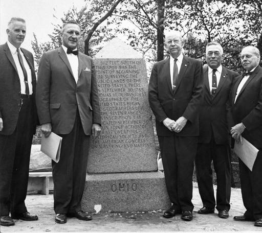
The five representatives of American Congress on Surveying and Mapping.
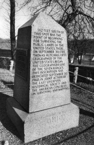
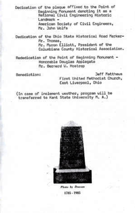
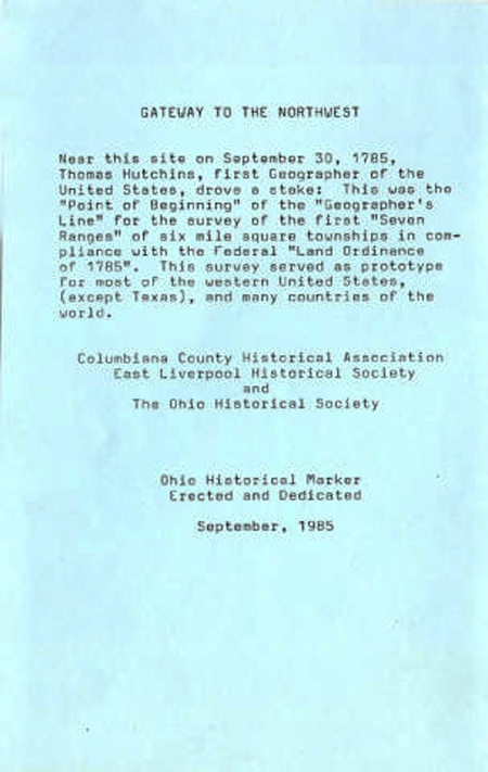
"Point of Beginning" Monument for the U.S. Public Land Surveys "1112 feet south of this spot was the "Point of Beginning" for surveying the public lands of the United States. There on September 30, 1785, Thomas Hutchins, first geographer of the United States began the Geographers' Line of the Seven Ranges. This inscription was dedicated September 30, 1960, in joint action of the East Liverpool Historical Society, and the American Congress on Surveying and Mapping. Ohio."--Inscription on the "west face" of the marker. The present monument was set at the rivers' edge in 1881 when the Ohio-Pennsylvania Boundary was re-surveyed and re-marked. In the 1960s the monument was endangered by an industrial land fill along the river, it was moved in 1960, 1112 feet north near the River Road between East Liverpool, Ohio and Midland, Pennsylvania.
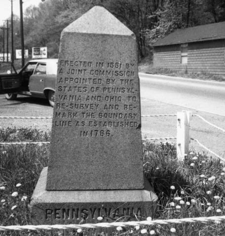
"Erected in 1881 by a joint commission appointed by the states of Pennsylvania and Ohio to re-survey and re-mark the boundary line as established in 1786. Pennsylvania."--Inscription on the "east face" of the marker. Congress passed the Land Ordinance of 1785, which defined a township as 6 miles by 6 miles, with baselines north-south and east-west, for all lands west of this point. The 36 individual square miles of a township are called sections. Near this monument was the first surveyor's marker from which all surveys west of this point, except Texas, radiate.
Point of Beginning - 1985 Dedication


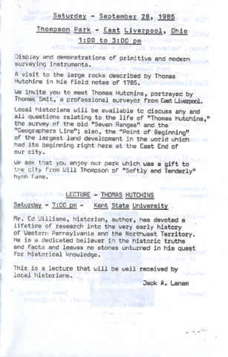
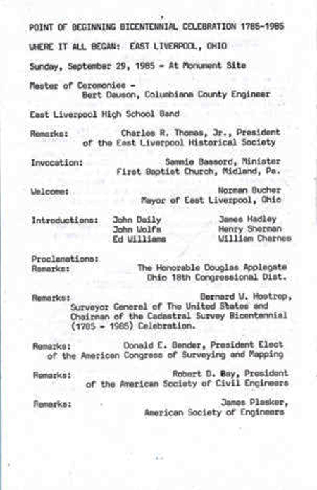
SOME PERSONAL ACCOUNTS: Timothy Brookes I was present at the 1985 ceremony, solely as an observer. Jack Lanam had made all the arrangements and was the "man in charge". It was a warm day and stress levels were fairly high. Jack was concerned that certain politicians would attempt to show-boat and interfere with his tightly organized schedule. What really struck me as humorous was when an uninvited VFW or American Legion drill team from another county showed up and announced that they wanted to fire a salute. Jack told them, with some heat, that they hadn't been invited and that no salute was wanted. They advised that they were there and nobody could stop them. Jack's coloring was remarkable but they fired their Garands and immediately left the ceremony. Local history is fun on so many levels. [Timothy Brookes is a local attorney in ELO and President of the East Liverpool Historical Society.]
ADDITIONAL INFORMATION
NATIONAL HISTORICAL LANDMARKS
Beginning Point of the U.S. Public Land Survey
http://tps.cr.nps.gov/nhl/detail.cfm?ResourceId=441&ResourceType=Site
There is one error in this one. It says this "is located besides a four-lane busy road with heavy traffic". That is false. It is located beside a two-lane road with a lot of truck traffic especially.
This one offers a satellite view. You have to scroll down to see the view on the page.
http://www.archiplanet.org/wiki/Beginning_Point_of_the_U.S._Public_Land_Survey
This site is the property of the East Liverpool Historical Society.
Regular linking, i.e. providing the URL of the East Liverpool Historical Society web site for viewers to click on and be taken to the East Liverpool Historical Society entry portal or to any specific article on the website is legally permitted.
Hyperlinking, or as it is also called framing, without permission is not permitted.
Legally speaking framing is still in a murky area of the law though there have been court cases in which framing has been seen as violation of copyright law. Many cases that were taken to court ended up settling out-of-court with the one doing the framing agreeing to cease framing and to just use a regular link to the other site.
The East Liverpool Historical Society pays fees to keep their site online. A person framing the Society site is effectively presenting the entire East Liverpool Historical Society web site as his own site and doing it at no cost to himself, i.e. stealing the site.
The East Liverpool Historical Society reserves the right to charge such an individual a fee for the use of the Society’s material.